Business Details
33 Years
experience
Expert Land Survey Services Isle of Wight & Hampshire
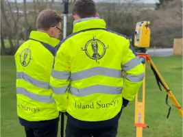
Established in 1993, Island Survey Systems has built a reputation as a trusted land surveying company serving the Isle of Wight and southern UK. Our team of skilled professionals utilises cutting-edge technology, including Trimble Total Stations and X7 Laser Scanners, to deliver millimetre-accurate measurements for diverse projects. With 30 years of industry experience, we specialise in topographical surveys, 3D laser scanning, and UAV inspections, providing data that balances accessibility for non-experts with precision for technical clients. Our work supports national utilities, local councils, and private individuals, demonstrated through landmark projects like the Ryde Interchange topographic data provision. Holding 2M professional indemnity insurance, we combine local knowledge with technical expertise to offer fixed-price quotations and tailored solutions.Our team includes qualified professionals with CSCS, SHEA GAS, and CAA certifications, ensuring compliance with industry standards. From garden landscaping levels to large-scale infrastructure projects, we maintain rigorous quality control across all survey types. Our Hampshire branch extends service capabilities across eight counties, maintaining the same high standards as our Isle of Wight headquarters. Client testimonials highlight our prompt service, technical proficiency, and ability to deliver complex plans within tight deadlines. This combination of experience, technology, and client-focused service positions us as reliable surveying partners for both public and private sector clients.
Services
3D Laser Scanning
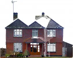
Measured Building Surveys
UAV Survey Services
Boundary Surveys
Elevation Surveys
As Built Surveys
Coastal Surveys
Tree Positioning
Site Setting-Out
Details
- Year established: 1993
Highlights and features
- 30 years of surveying experience since 1993
- Uses Trimble Total Stations and X7 Laser Scanners
- Offers fixed-price quotations with no hidden costs
- Maintains 2M professional indemnity insurance
- Provides local knowledge with national standards
Associations and certifications
- CAA GVC
- CSCS
- SHEA GAS
What people say
Highly knowledgeable
Professional and helpful
Pinpoint accuracy
Excellent drawings
Completed quickly
Services
3D Laser Scanning
Our 3D laser scanning service captures precise spatial data using X7 Laser Scanners. This technology creates detailed digital models for building analysis and construction projects. Clients receive accurate measurements that facilitate informed decision-making and project planning.
Measured Building Surveys
We conduct comprehensive measured building surveys using advanced surveying equipment. These surveys produce detailed floor plans and elevations for property renovations or extensions. Our data helps architects and contractors with precise spatial planning.
UAV Survey Services
Our UAV survey services utilise drones for aerial mapping and site inspections. This method provides efficient data collection for large areas or difficult-to-access locations. Clients benefit from rapid survey completion and detailed aerial imagery analysis.
Boundary Surveys
We perform boundary surveys to establish property lines using title deeds and physical markers. Our surveys help resolve disputes and support land transactions. Clients receive accurate documentation for legal and development purposes.
Elevation Surveys
Our elevation surveys measure vertical dimensions of buildings and land features. This data supports architectural design and construction planning. Clients receive precise information for creating accurate building elevations and site plans.
People
Andrew J. Foulkes
Principal Surveyor
HND qualified Civil Engineer with CSCS certification. Leads survey operations and technical direction. Brings extensive practical experience in land surveying and project management to client engagements.
Michael Foulkes
Consulting Surveyor
BEng Hons Engineering Geology graduate with EURS accreditation. Provides specialist surveying expertise and technical oversight. Holds multiple certifications including SHEA GAS and CAA GVC for UAV operations.
Michael D. Foulkes
Senior Surveyor
PhD holder with memberships in ICE, IHT, and IES. Specialises in engineering geology applications. Provides advanced technical analysis and contributes to complex surveying projects requiring specialist expertise.
Questions
What surveying services do you offer?
We provide 3D laser scanning, measured building surveys, UAV inspections, boundary surveys, elevation surveys, and as-built surveys using advanced equipment.
Which areas do you cover?
We operate from the Isle of Wight and Hampshire, serving Surrey, Kent, London, Sussex, Berkshire, Buckinghamshire, Oxfordshire, Wiltshire, and Dorset.
How can I request a quote?
Complete our contact form with survey requirements and site address to receive a fixed-price quotation from our team.
Are you insured for surveying work?
Yes, all our work is covered by £2 million professional indemnity insurance for client protection.
What experience do you have?
Established in 1993 with 30 years' experience, we've worked on major projects including Southern Water infrastructure and Isle of Wight Council developments.
What technology do you use?
We utilise Trimble Total Stations, X7 Laser Scanners, and UAV drones to ensure millimetre-accurate survey measurements and digital modelling.